Tuesday 25 March 2008

The Jan Kjellström International Festival of Orienteering 2008


The Jan Kjellström International Festival of Orienteering (also known as the JK) has held a permanent place in my yearly fixture list since 2005. I suspect this will be the case for many years. With over 4500 competitors in 2008, this is Britain’s largest orienteering event. The JK commemorates Jan Kjellström, a Swedish orienteer and pioneer of the sport in the UK who tragically died in a car crash. Held over the Easter weekend, the event location changes every year around Britain, offering competitors diverse and top quality terrain.

The JK2008 is based in Sussex, South of England, with the event centre being based at Crowborough Army Camp.

Saturday’s Event was held at Leith Hill, the area used for the 2005 World Cup Middle Race

This is taken from the organisers notes:

“The NW part of the area will be used by the courses from the Far Start only. The forest is mostly runnable with some small areas of thick vegetation. It is undulating with some contour detail and has high visibility throughout. To succeed here, you will need to combine high speed with accurate compass work, and look up to make sure you use the high visibility to your advantage.”

“The SW part of the area will be used by the courses from the Far and Mid Starts. This was used for World Cup 2005 and is a combination of some gently rolling areas dotted with thickets, and some flatter, but extremely technical areas with many small paths, highly complex contours, and some ground vegetation (knot weed) that can make passage difficult (indicated by vertical green stripes). To succeed here, you will need to use clear attack points and know when to slow down to spike your control.”

M20L Course Stats:

Minimum Length: 9.6km / 6miles

Minimum Climb: 345m / 1130ft

(Straight line distances/heights)

Making this equivalent to at least a BM fell race

Race Day:

Tough race in foul conditions! Snow, hailstone and gales were just part of the monopoly of weathers thrown down upon us making for difficult running. A running time of 89:35 minutes reflects tough navigation and many necessary deviations from the straight line. Most of the running was through rough forest and knee deep mud, paths were an unusual but welcome sight. Navigation was spot on apart from one silly mistake on the penultimate checkpoint, sprinting off down the wrong side of a large spur, only to have run back up it.

Complex Terrain:


Sunday’s Event was held at Ashdown Forest

This is taken from the organisers notes:

Ashdown Forest comprises a fabulously wide variety of terrain ranging from runnable deciduous woodland through open heath to significant areas of tussock grass.There is extensive bracken which is generally runnable. The area is incised by four major valleys and provides physically challenging courses with few areas of flat land.There is a very extensive track and path network.”

M20L Course Stats:

Minimum Length: 10.3km / 6.4 miles

Minimum Climb: 480m / 1570ft

(Straight line distances/heights)

Making this equivalent to at least an AM fell race.

Race Day:

Ouch! This was a very painful race both mentally and physically, made worse by atrocious snowy weather. After a rapid start, the pace was soon reduced as the effects of yesterday made their presence felt. Having a later start time than the Saturday meant the underfoot conditions were very churned up. Progress was slow. Today was a mixture of complicated forest, open moorland and orange mud!!

Around control 11, three quarters of the way round, I hit the proverbial wall. Feeling very low sugar levels, the hill up to the finish wasn’t a welcoming sight. Total running time of 110:19 minutes.

Difficult Route Choice:


Monday, the Relay at Eridge Old Park

More snow, horrible conditions, paths covered in snow and visibility poor. Not a bad run, team PFO Pacemakers finished 29th on the Men’s Short Class. All ready to come home when a lost teammate on a different PFO team, who’d been out for 3 hours needed finding, resulting in a time consuming search. All safe!

Thursday 20 March 2008

Edinburgh - The City with Fells!

Built on a series of Volcanoes from the Carboniferous period, Edinburgh must be one of the hilliest cities in Britain. The maze which is the old town is interlinked with many secret alleys and seemingly unending stairways, perfect terrain for a street orienteering event!

Then within about 5 minutes from the centre lies Holyrood Park containing Arthur's Seat. In real terms its not exactly massive at 250m, but it's prominence from the surrounding city, and it's steep basalt crags make it the feel almost 'mountainous.'


And upon seeing the picturesque scene of the ruins of St Andrew's Chapel from St Margaret's Loch, It's hard to believe Edinburgh is just round the corner:


As such, Edinburgh I think potential for an enormously successful urban/rural adventure race. It would seem that others were like minded and created the Edinburgh Rat Race, one for the future!!

Sunday 16 March 2008

Coughs and Sneezes Spread Diseases - Easy Week

I've not been on top form this week with a nasty cold, as such training reduced to 30 minutes in the gym on thursday and an easy 60 minute trail run today. Although, an easy run when on form is not an easy run when ill.

Managing only 4 miles, I've decided severe rest is in order before next weekends JK International Festival of Orienteering in the South East. Sadly, this will mean missing out training on Holyrood Park and Arthur's Seat (the home to the World Cross Country Championships, to be held on the 30th March 2008), when in Edinburgh on Tuesday, but performance at the weekend should hopefully make up for it.

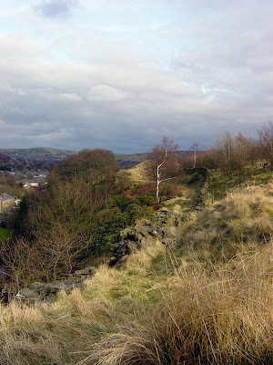
Some pictures of the Valley from above the Glen Tunnels today:


Sunday 9 March 2008

Top of Leach, Knowl Hill, Whittle Pike and Cowpe Lowe - 12 miles

This run takes in Rossendale's 4 biggest hills. Here is a brief route description of places in order of passing:

Red Lion Pub in Higher Cloughfold, Waterfoot, Glen Playing Fields, Rooley Moor Road, Top of Leach, Rooley Moor Road, SD 859 179, Higher Naden Reseroir, Lady Lees Woods, Rochdale Way, Knowl Hill, Man Road Ditch, Higher Hill, Whittle Hill, Waughs Well, Rossendale Way, Cowpe Lowe, Whinberry Naze, Red Lion Pub in Higher Cloughfold.

The plan was to become more comfortable on longer runs with multiple climbs and this route didn't disappoint. With steep climbs from Waterfoot to Top of Leach, Higher Naden to Knowl Hill and from Waughs Well Reservoir to Cowpe Lowe Summit. Total climb of 900m or 2950ft completed in 2 hours 18 minutes. Conditions were fantastic apart from the odd brief spell of stinging hail showers, Hence no pictures from Top of Leach

The route up Knowl Hill:


The Sky above Rochdale and Manchester:


Knowl Hill Summit with Ashworth Moor Reservoir Beyond:


The highly opposed Scout Moor Wind Farm:


The Summit of Whittle Pike marks a memorial to Flying Officer Geoffrey Molyneux:


Views from the summit of Cowpe Lowe:


Winter Hill from Cowpe Lowe:


My New Favourite Run!

Course Stats

Length: 12 miles / 19.2km
Climb: 900m / 2950ft
Time: 2 hours 18 minutes

Friday 7 March 2008

Windy Clowbridge Trail Run - 6 miles

You've gotta be really unlucky to be on a circular run and have the wind in your face the entire way round. Today was not a lucky day with unpleasant gales making running and biking tough going.

And with severe weather warnings for Monday and Tuesday forecasting severe, property damaging gales of up to 80mph, things are going to get worse before they get better.


Monday 3 March 2008

Cowpe Lowe at Night.... is a very scary place!

A depression over Britain coupled with a high pressure system over Greenland, has brought in bouts of wintry weather dumping lots of snow and ice on the previously well thawed Lakes, leaving them a bit too unpredictable for fell running. So instead of resting in preparation for Thursday and Friday running in Great Langdale, I decided to brave the dark and treat myself to a run up Cowpe Lowe.

As such I learnt a few scary things, and reminded myself of others:
  • Hills of a modest 440m can be scary at night when solo.
  • Sheep can be scary at night, as their eyes glow luminous green.
  • Head torches are not too good in mist, often well adjusted eyes are better.
Also despite the wild puma rumoured to be on the loose, regrettably I didn't come across the cat or any of the rumoured 5inch paw prints in the snow. After being blinded by the light reflecting in the mist, it was of no surprise when I nearly ran into the concrete trig point. Very exhilarating, something to try at least once.

The trig (apologies for the low quality of my phone pics):


NOTE: It's probably a good idea to be uber familiar with the route before attempting it at night.